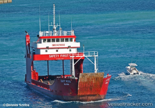
East Wind
Current StatusWhere is the vessel?
East Wind is currently in Near Great Exuma Island, based on AIS data received about 15h ago.
Latest AIS update:
Current position: 23.50756° N, 75.76724° W (Near Great Exuma Island)
Average speed (last 7 days): Loading…
Average speed (last 30 days): Loading…
Vessel profile: East Wind is a Ro Ro Cargo Ship with dimensions 11m x 54m.
This page combines live AIS, route history, probable destination signals, nearby traffic, and port activity for practical vessel monitoring.
The current position of vessel East Wind is 23.50756 lat / -75.76724 lng. Updated: 2026-05-22 16:33:56 UTCNearest reference points:
- Near Great Exuma Island
- 30 nm SW of Cape Eleuthera
- 29 nm SW of Cape Eleuthera
Details:
Live Vessel East Wind Analytics (details, animations, etc.)
Recent AIS points (UTC):
2026-05-22 13:25:13 UTC · 23.61558, -75.85132 · SOG 9.6 kn · COG -1°2026-05-22 13:36:22 UTC · 23.59375, -75.83087 · SOG 9.7 kn · COG -1°
2026-05-22 16:22:52 UTC · 23.50757, -75.76726 · SOG 0 kn · COG -1°
2026-05-22 16:33:56 UTC · 23.50756, -75.76724 · SOG 0 kn · COG -1°