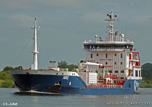
 Nike
Nike
Current Status
Where is the vessel?
Nike is currently in 13 nm SE of Idestrup, based on AIS data received about 14h ago.
Latest AIS update:
Current position: 54.62574° N, 12.30172° E (13 nm SE of Idestrup)
Average speed (last 7 days): Loading…
Average speed (last 30 days): Loading…
Vessel profile: Nike is a Chemical Oil Products Tanker with dimensions 122m x 17m.
This page combines live AIS, route history, probable destination signals, nearby traffic, and port activity for practical vessel monitoring.
The current position of vessel Nike is 54.62574 lat / 12.30172 lng. Updated: 2026-05-21 14:05:49 UTCNearest reference points:
- 10 nm NW of Graal-Müritz
- Near Pruchten
- Near Warnemunde
Currently sailing under the flag of Malta ![]()
Nike built in 2009 year
Deadweight:
7770 tDetails:
Live Vessel Nike Analytics (details, animations, etc.)
Recent AIS points (UTC):
2026-05-21 11:01:12 UTC · 54.89635, 13.21902 · SOG 11.6 kn · COG 246°2026-05-21 11:31:31 UTC · 54.86416, 13.06308 · SOG 10.9 kn · COG 248°
2026-05-21 13:39:28 UTC · 54.67416, 12.42137 · SOG 11.5 kn · COG 228°
2026-05-21 14:05:49 UTC · 54.62574, 12.30172 · SOG 11.7 kn · COG 242°