 Al Nuaman
Current Status
Where is the vessel?
Al Nuaman is currently in 353 nm E of Aquiraz, based on AIS data received about 14h ago.
Latest AIS update:
Current position: 4.09674° S, 22.47518° W (353 nm E of Aquiraz)
Average speed (last 7 days): Loading…
Average speed (last 30 days): Loading…
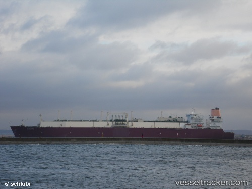
Vessel profile: Al Nuaman is a Lng Tanker with dimensions 315m x 50m.
This page combines live AIS, route history, probable destination signals, nearby traffic, and port activity for practical vessel monitoring.
The current position of vessel Al Nuaman is -4.09674 lat / -22.47518 lng. Updated: 2026-05-22 22:23:53 UTCNearest reference points:
- Open sea (no nearby ports in database)
- Open sea, approx. 404 nm off the nearest listed port
- Open sea, approx. 405 nm off the nearest listed port
Currently sailing under the flag of Marshall Is ![]()
Al Nuaman built in 2009 year
Deadweight:
121910 tDetails:
Live Vessel Al Nuaman Analytics (details, animations, etc.)
Recent AIS points (UTC):
2026-05-22 18:06:59 UTC · -3.30667, -23.28667 · SOG 16 kn · COG -1°2026-05-22 19:39:54 UTC · -3.58667, -22.99167 · SOG 16 kn · COG -1°
2026-05-22 20:12:55 UTC · -3.68500, -22.88500 · SOG 16 kn · COG -1°
2026-05-22 22:23:53 UTC · -4.09674, -22.47518 · SOG 15.9 kn · COG 133°