 UOG KYMA
Current Status
Where is the vessel?
UOG KYMA is currently in Near Amsterdam, based on AIS data received about 15h ago.
Latest AIS update:
Current position: 52.40319° N, 4.87271° E (Near Amsterdam)
Average speed (last 7 days): Loading…
Average speed (last 30 days): Loading…
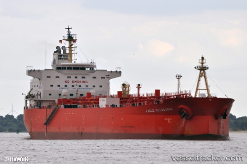
Vessel profile: UOG KYMA is a Oil Products Tanker with dimensions m x m.
This page combines live AIS, route history, probable destination signals, nearby traffic, and port activity for practical vessel monitoring.
The current position of vessel UOG KYMA is 52.40319 lat / 4.87271 lng. Updated: 2026-05-21 20:09:54 UTCNearest reference points:
- Near Amsterdam
- Near ZAANDAM
- Near Zaanstad
Currently sailing under the flag of Cyprus ![]()
Details:
Live Vessel UOG KYMA Analytics (details, animations, etc.)
Recent AIS points (UTC):
2026-05-21 17:06:53 UTC · 52.40313, 4.87269 · SOG 0 kn · COG 52°2026-05-21 18:04:09 UTC · 52.40311, 4.87269 · SOG 0 kn · COG 52°
2026-05-21 19:51:55 UTC · 52.40322, 4.87267 · SOG 0 kn · COG 52°
2026-05-21 20:09:54 UTC · 52.40319, 4.87271 · SOG 0 kn · COG 51°