Peggy Way
Current StatusWhere is the vessel?
Peggy Way is currently in 42 nm SE of Chimu Wan, based on AIS data received about 14h ago.
Latest AIS update:
Current position: 25.97313° N, 128.59296° E (42 nm SE of Chimu Wan)
Average speed (last 7 days): Loading…
Average speed (last 30 days): Loading…
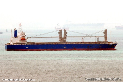
Vessel profile: Peggy Way is a General Cargo Ship with dimensions 20m x 128m.
This page combines live AIS, route history, probable destination signals, nearby traffic, and port activity for practical vessel monitoring.
The current position of vessel Peggy Way is 25.97313 lat / 128.59296 lng. Updated: 2026-05-20 11:24:28 UTCNearest reference points:
- 18 nm W of Koniya
- 77 nm SE of Miyakojima
Details:
Live Vessel Peggy Way Analytics (details, animations, etc.)
Recent AIS points (UTC):
2026-05-20 04:27:50 UTC · 26.87433, 129.66299 · SOG 11 kn · COG 229°2026-05-20 04:27:50 UTC · 26.87433, 129.66299 · SOG 11 kn · COG 229°
2026-05-20 04:27:50 UTC · 26.87433, 129.66299 · SOG 11 kn · COG 229°
2026-05-20 11:24:28 UTC · 25.97313, 128.59296 · SOG 11.3 kn · COG 232°