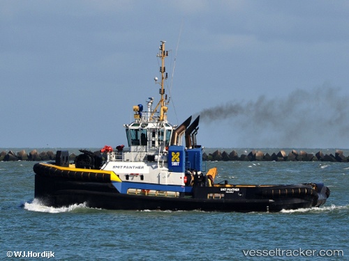
 VB PANTHER
Current Status
Where is the vessel?
VB PANTHER is currently in Near THAMES, based on AIS data received about 15h ago.
Latest AIS update:
Current position: 51.50552° N, 0.51784° E (Near THAMES)
Average speed (last 7 days): Loading…
Average speed (last 30 days): Loading…
Vessel profile: VB PANTHER is a Tug with dimensions m x m.
This page combines live AIS, route history, probable destination signals, nearby traffic, and port activity for practical vessel monitoring.
The current position of vessel VB PANTHER is 51.50552 lat / 0.51784 lng. Updated: 2026-05-19 19:32:10 UTCNearest reference points:
- Near GILLINGHAM
- Near Gravesend
- Near HEYBRIDGE
Currently sailing under the flag of United Kingdom ![]()
Details:
Live Vessel VB PANTHER Analytics (details, animations, etc.)
Recent AIS points (UTC):
2026-05-19 16:20:12 UTC · 51.50556, 0.51782 · SOG 0.1 kn · COG 80°2026-05-19 17:20:55 UTC · 51.50500, 0.51667 · SOG 0 kn · COG -1°
2026-05-19 19:26:15 UTC · 51.50553, 0.51783 · SOG 0 kn · COG 75°
2026-05-19 19:32:10 UTC · 51.50552, 0.51784 · SOG 0 kn · COG 80°