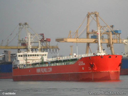
 AFRICAN STAR
Current Status
Where is the vessel?
AFRICAN STAR is currently in Near Bonny, based on AIS data received about 16h ago.
Latest AIS update:
Current position: 4.33148° N, 7.10480° E (Near Bonny)
Average speed (last 7 days): Loading…
Average speed (last 30 days): Loading…
Vessel profile: AFRICAN STAR is a Oil Products Tanker with dimensions m x m.
This page combines live AIS, route history, probable destination signals, nearby traffic, and port activity for practical vessel monitoring.
The current position of vessel AFRICAN STAR is 4.33148 lat / 7.10480 lng. Updated: 2026-05-21 22:00:51 UTCNearest reference points:
- Near Bonny
- 21 nm SW of Bonny
- Near Ima
Currently sailing under the flag of Nigeria ![]()
Details:
Live Vessel AFRICAN STAR Analytics (details, animations, etc.)
Recent AIS points (UTC):
2026-05-21 10:12:11 UTC · 4.33286, 7.10525 · SOG 0.5 kn · COG 162°2026-05-21 10:12:11 UTC · 4.33286, 7.10525 · SOG 0.5 kn · COG 162°
2026-05-21 21:50:54 UTC · 4.33167, 7.10333 · SOG 0 kn · COG -1°
2026-05-21 22:00:51 UTC · 4.33148, 7.10480 · SOG 0.2 kn · COG 98°