 Athens Highway
Current Status
Where is the vessel?
Athens Highway is currently in 59 nm N of Tubualá, based on AIS data received about 14h ago.
Latest AIS update:
Current position: 10.46425° N, 78.77200° W (59 nm N of Tubualá)
Average speed (last 7 days): Loading…
Average speed (last 30 days): Loading…
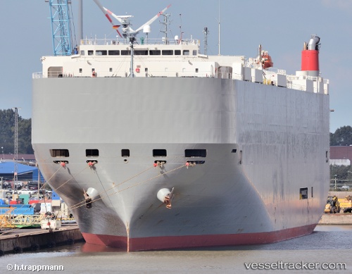
Vessel profile: Athens Highway is a Vehicles Carrier with dimensions 200m x 200m.
This page combines live AIS, route history, probable destination signals, nearby traffic, and port activity for practical vessel monitoring.
The current position of vessel Athens Highway is 10.46425 lat / -78.77200 lng. Updated: 2026-05-19 07:11:27 UTCNearest reference points:
- 62 nm NE of Playón Chico
- Near COLON 2000
- Near Colon
Currently sailing under the flag of Japan ![]()
Athens Highway built in 2008 year
Deadweight:
18809 tDetails:
Live Vessel Athens Highway Analytics (details, animations, etc.)
Recent AIS points (UTC):
2026-05-19 04:18:56 UTC · 10.96220, -78.08800 · SOG 17.6 kn · COG 233°2026-05-19 04:37:18 UTC · 10.90747, -78.16138 · SOG 17.8 kn · COG 235°
2026-05-19 06:21:20 UTC · 10.60690, -78.57510 · SOG 17.2 kn · COG 234°
2026-05-19 07:11:27 UTC · 10.46425, -78.77200 · SOG 17.2 kn · COG 236°