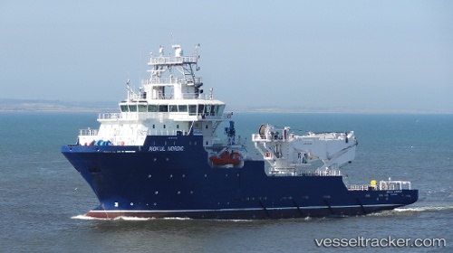
 SAFEEN SURVEYOR
Current Status
Where is the vessel?
SAFEEN SURVEYOR is currently in Near RAS LAFFAN, based on AIS data received about 14h ago.
Latest AIS update:
Current position: 25.87345° N, 51.68670° E (Near RAS LAFFAN)
Average speed (last 7 days): Loading…
Average speed (last 30 days): Loading…
Vessel profile: SAFEEN SURVEYOR is a Offshore Supply Ship with dimensions m x m.
This page combines live AIS, route history, probable destination signals, nearby traffic, and port activity for practical vessel monitoring.
The current position of vessel SAFEEN SURVEYOR is 25.87345 lat / 51.68670 lng. Updated: 2026-05-22 05:34:37 UTCNearest reference points:
- Near RAS LAFFAN
- 21 nm NE of Halul Island
- Near KHALIFA BIN SALMAN
Currently sailing under the flag of United Arab Emirates ![]()
Details:
Live Vessel SAFEEN SURVEYOR Analytics (details, animations, etc.)
Recent AIS points (UTC):
2026-05-21 20:59:34 UTC · 25.87093, 51.69921 · SOG 0.1 kn · COG -1°2026-05-22 03:26:55 UTC · 25.86953, 51.67544 · SOG 1 kn · COG 160°
2026-05-22 04:08:56 UTC · 25.86061, 51.69459 · SOG 0.5 kn · COG -1°
2026-05-22 05:34:37 UTC · 25.87345, 51.68670 · SOG 0.3 kn · COG -1°