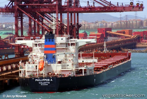
 Philippos A.
Current Status
Where is the vessel?
Philippos A. is currently in 62 nm NW of Labuanbajo, based on AIS data received about 14h ago.
Latest AIS update:
Current position: 0.81856° N, 119.48945° E (62 nm NW of Labuanbajo)
Average speed (last 7 days): Loading…
Average speed (last 30 days): Loading…
Vessel profile: Philippos A. is a Bulk Carrier with dimensions 291m x 45m.
This page combines live AIS, route history, probable destination signals, nearby traffic, and port activity for practical vessel monitoring.
The current position of vessel Philippos A. is 0.81856 lat / 119.48945 lng. Updated: 2026-05-20 02:14:10 UTCNearest reference points:
- 69 nm E of Kaliorang
- 29 nm W of Labuanbajo
- 39 nm W of Labuanbajo
Currently sailing under the flag of Malta ![]()
Details:
Live Vessel Philippos A. Analytics (details, animations, etc.)
Recent AIS points (UTC):
2026-05-19 23:04:10 UTC · 0.33344, 119.30541 · SOG 10 kn · COG 20°2026-05-19 23:57:50 UTC · 0.46764, 119.36286 · SOG 10 kn · COG 25°
2026-05-20 02:00:29 UTC · 0.78159, 119.47860 · SOG 10.2 kn · COG 18°
2026-05-20 02:14:10 UTC · 0.81856, 119.48945 · SOG 10.1 kn · COG 15°