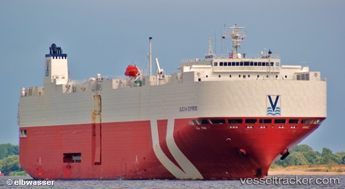
 SIEM COPERNICUS
Current Status
Where is the vessel?
SIEM COPERNICUS is currently in 38 nm W of Tindalo Oil Field, based on AIS data received about 1d ago.
Latest AIS update:
Current position: 10.85654° N, 118.28710° E (38 nm W of Tindalo Oil Field)
Average speed (last 7 days): Loading…
Average speed (last 30 days): Loading…
Vessel profile: SIEM COPERNICUS is a Vehicles Carrier with dimensions m x m.
This page combines live AIS, route history, probable destination signals, nearby traffic, and port activity for practical vessel monitoring.
The current position of vessel SIEM COPERNICUS is 10.85654 lat / 118.28710 lng. Updated: 2026-05-18 23:07:12 UTCNearest reference points:
- 43 nm W of Malampaya
- 70 nm W of Puerto Princesa
- 65 nm NW of Malampaya
Currently sailing under the flag of Singapore ![]()
Details:
Live Vessel SIEM COPERNICUS Analytics (details, animations, etc.)
Recent AIS points (UTC):
2026-05-18 23:07:12 UTC · 10.85654, 118.28710 · SOG 11 kn · COG 29°2026-05-18 23:07:12 UTC · 10.85654, 118.28710 · SOG 11 kn · COG 29°
2026-05-18 23:07:12 UTC · 10.85654, 118.28710 · SOG 11 kn · COG 29°
2026-05-18 23:07:12 UTC · 10.85654, 118.28710 · SOG 11 kn · COG 29°