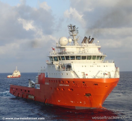
 BOKA FULMAR
Current Status
Where is the vessel?
BOKA FULMAR is currently in Near NAUERNA, based on AIS data received about 14h ago.
Latest AIS update:
Current position: 52.42062° N, 4.76827° E (Near NAUERNA)
Average speed (last 7 days): Loading…
Average speed (last 30 days): Loading…
Vessel profile: BOKA FULMAR is a Anchor Handling Vessel with dimensions m x m.
This page combines live AIS, route history, probable destination signals, nearby traffic, and port activity for practical vessel monitoring.
The current position of vessel BOKA FULMAR is 52.42062 lat / 4.76827 lng. Updated: 2026-05-22 19:59:53 UTCNearest reference points:
- Near NAUERNA
- Near ZAANDAM
- Near Lijnden
Currently sailing under the flag of Belgium ![]()
Details:
Live Vessel BOKA FULMAR Analytics (details, animations, etc.)
Recent AIS points (UTC):
2026-05-22 16:38:11 UTC · 52.42063, 4.76828 · SOG 0 kn · COG 162°2026-05-22 17:26:16 UTC · 52.42062, 4.76828 · SOG 0 kn · COG 163°
2026-05-22 19:20:12 UTC · 52.42063, 4.76827 · SOG 0 kn · COG 162°
2026-05-22 19:59:53 UTC · 52.42062, 4.76827 · SOG 0 kn · COG 162°