 XIN HAI TONG 66
Current Status
Where is the vessel?
XIN HAI TONG 66 is currently in Near Ha Long, based on AIS data received about 15h ago.
Latest AIS update:
Current position: 20.83538° N, 107.14587° E (Near Ha Long)
Average speed (last 7 days): Loading…
Average speed (last 30 days): Loading…
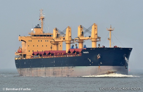
Vessel profile: XIN HAI TONG 66 is a Bulk Carrier with dimensions m x m.
This page combines live AIS, route history, probable destination signals, nearby traffic, and port activity for practical vessel monitoring.
The current position of vessel XIN HAI TONG 66 is 20.83538 lat / 107.14587 lng. Updated: 2026-05-19 00:07:18 UTCNearest reference points:
- 14 nm SE of Nam Hai Dinh Vu Port
- 18 nm SE of Ha Long
- 12 nm SE of Nam Hai Dinh Vu Port
Currently sailing under the flag of Marshall Islands ![]()
Details:
Live Vessel XIN HAI TONG 66 Analytics (details, animations, etc.)
Recent AIS points (UTC):
2026-05-18 19:41:54 UTC · 20.83468, 107.14883 · SOG 0.2 kn · COG -1°2026-05-18 21:47:05 UTC · 20.83570, 107.14912 · SOG 0 kn · COG -1°
2026-05-18 22:22:08 UTC · 20.83592, 107.14900 · SOG 0.1 kn · COG -1°
2026-05-19 00:07:18 UTC · 20.83538, 107.14587 · SOG 0 kn · COG -1°