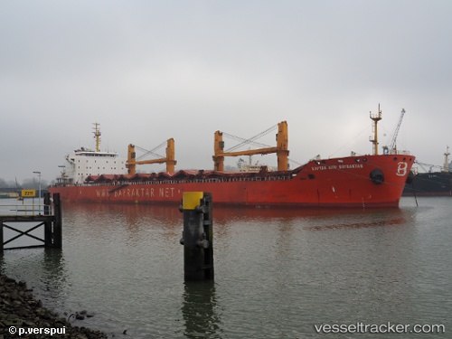
 KAPTAN ARIFBAYRAKTAR
Current Status
Where is the vessel?
KAPTAN ARIFBAYRAKTAR is currently in 135 nm NW of Port Mathurin, based on AIS data received about 15h ago.
Latest AIS update:
Current position: 17.80550° S, 62.10500° E (135 nm NW of Port Mathurin)
Average speed (last 7 days): Loading…
Average speed (last 30 days): Loading…
Vessel profile: KAPTAN ARIFBAYRAKTAR is a Bulk Carrier with dimensions m x m.
This page combines live AIS, route history, probable destination signals, nearby traffic, and port activity for practical vessel monitoring.
The current position of vessel KAPTAN ARIFBAYRAKTAR is -17.80550 lat / 62.10500 lng. Updated: 2026-05-19 07:45:22 UTCNearest reference points:
- 106 nm NW of Port Mathurin
- 219 nm NW of Port Mathurin
- 241 nm N of Port Mathurin
Currently sailing under the flag of Marshall Islands ![]()
Details:
Live Vessel KAPTAN ARIFBAYRAKTAR Analytics (details, animations, etc.)
Recent AIS points (UTC):
2026-05-19 04:50:43 UTC · -17.44333, 62.59317 · SOG 12.5 kn · COG 230°2026-05-19 05:52:50 UTC · -17.56883, 62.42233 · SOG 12.5 kn · COG 230°
2026-05-19 07:39:02 UTC · -17.79767, 62.12633 · SOG 12.5 kn · COG 252°
2026-05-19 07:45:22 UTC · -17.80550, 62.10500 · SOG 12.4 kn · COG 251°