 JOLLY ORO
Current Status
Where is the vessel?
JOLLY ORO is currently in 229 nm SE of Masirah, based on AIS data received about 2d ago.
Latest AIS update:
Current position: 18.80167° N, 62.50167° E (229 nm SE of Masirah)
Average speed (last 7 days): Loading…
Average speed (last 30 days): Loading…
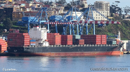
Vessel profile: JOLLY ORO is a Container Ship with dimensions m x m.
This page combines live AIS, route history, probable destination signals, nearby traffic, and port activity for practical vessel monitoring.
The current position of vessel JOLLY ORO is 18.80167 lat / 62.50167 lng. Updated: 2026-05-17 04:11:52 UTCNearest reference points:
- 262 nm SE of SUR
- 398 nm SE of Masirah
- Open sea, approx. 401 nm off the nearest listed port
Currently sailing under the flag of Italy ![]()
Details:
Live Vessel JOLLY ORO Analytics (details, animations, etc.)
Recent AIS points (UTC):
2026-05-17 04:11:52 UTC · 18.80167, 62.50167 · SOG 12 kn · COG -1°2026-05-17 04:11:52 UTC · 18.80167, 62.50167 · SOG 12 kn · COG -1°
2026-05-17 04:11:52 UTC · 18.80167, 62.50167 · SOG 12 kn · COG -1°
2026-05-17 04:11:52 UTC · 18.80167, 62.50167 · SOG 12 kn · COG -1°