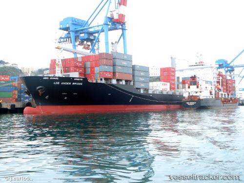
Los Andes Bridge
Current StatusWhere is the vessel?
Los Andes Bridge is currently in 88 nm N of Hatoma, based on AIS data received about 15h ago.
Latest AIS update:
Current position: 25.89333° N, 124.15500° E (88 nm N of Hatoma)
Average speed (last 7 days): Loading…
Average speed (last 30 days): Loading…
Vessel profile: Los Andes Bridge is a Container Ship with dimensions 32m x 200m.
This page combines live AIS, route history, probable destination signals, nearby traffic, and port activity for practical vessel monitoring.
The current position of vessel Los Andes Bridge is 25.89333 lat / 124.15500 lng. Updated: 2026-05-21 01:34:24 UTCNearest reference points:
- 120 nm NE of Nangang
- 76 nm NE of Nangang
- 55 nm E of Nangang
Details:
Live Vessel Los Andes Bridge Analytics (details, animations, etc.)
Recent AIS points (UTC):
2026-05-20 22:55:24 UTC · 25.38333, 123.91833 · SOG 12 kn · COG -1°2026-05-20 23:43:20 UTC · 25.53500, 123.98667 · SOG 12 kn · COG -1°
2026-05-21 01:22:28 UTC · 25.85333, 124.13833 · SOG 12 kn · COG -1°
2026-05-21 01:34:24 UTC · 25.89333, 124.15500 · SOG 12 kn · COG -1°