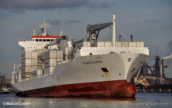
 ATLANTIC KLIPPER
Current Status
Where is the vessel?
ATLANTIC KLIPPER is currently in Near Kingstown, based on AIS data received about 14h ago.
Latest AIS update:
Current position: 13.15310° N, 61.22818° W (Near Kingstown)
Average speed (last 7 days): Loading…
Average speed (last 30 days): Loading…
Vessel profile: ATLANTIC KLIPPER is a Reefer/Container Ship with dimensions m x m.
This page combines live AIS, route history, probable destination signals, nearby traffic, and port activity for practical vessel monitoring.
The current position of vessel ATLANTIC KLIPPER is 13.15310 lat / -61.22818 lng. Updated: 2026-05-21 13:54:08 UTCNearest reference points:
- Near Kingstown
- 16 nm SW of Carriacou Apt
- Near Gros Islet
Currently sailing under the flag of Liberia ![]()
Details:
Live Vessel ATLANTIC KLIPPER Analytics (details, animations, etc.)
Recent AIS points (UTC):
2026-05-21 10:46:24 UTC · 13.14893, -61.22900 · SOG 1.6 kn · COG 8°2026-05-21 12:00:03 UTC · 13.15309, -61.22815 · SOG 0 kn · COG 296°
2026-05-21 13:54:08 UTC · 13.15310, -61.22818 · SOG 0 kn · COG 296°
2026-05-21 13:54:08 UTC · 13.15310, -61.22818 · SOG 0 kn · COG 296°