 KATJA
KATJA
Current Status
Where is the vessel?
KATJA is currently in 14 nm E of Craven Arms, based on AIS data received about 14h ago.
Latest AIS update:
Current position: 52.37995° N, 3.20146° E (14 nm E of Craven Arms)
Average speed (last 7 days): Loading…
Average speed (last 30 days): Loading…
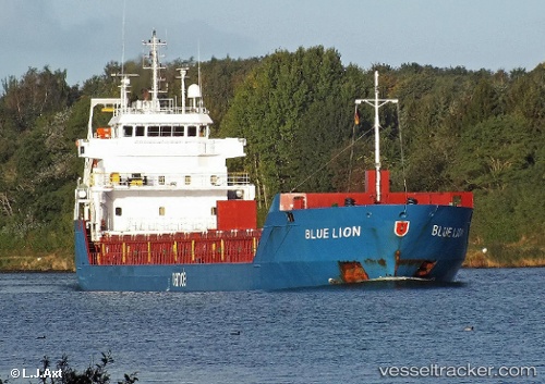
Vessel profile: KATJA is a General Cargo with dimensions m x m.
This page combines live AIS, route history, probable destination signals, nearby traffic, and port activity for practical vessel monitoring.
The current position of vessel KATJA is 52.37995 lat / 3.20146 lng. Updated: 2026-05-21 18:06:00 UTCNearest reference points:
- Near Craven Arms
- Near Hunsdon
- 12 nm NE of Hunsdon
Currently sailing under the flag of Antigua and Barbuda ![]()
Details:
Live Vessel KATJA Analytics (details, animations, etc.)
Recent AIS points (UTC):
2026-05-21 14:05:17 UTC · 52.89522, 3.85616 · SOG 10.9 kn · COG 219°2026-05-21 15:56:00 UTC · 52.64341, 3.51615 · SOG 9.9 kn · COG 216°
2026-05-21 17:07:28 UTC · 52.49425, 3.33490 · SOG 8.8 kn · COG 212°
2026-05-21 18:06:00 UTC · 52.37995, 3.20146 · SOG 8.6 kn · COG 212°