 vesseltracker.com
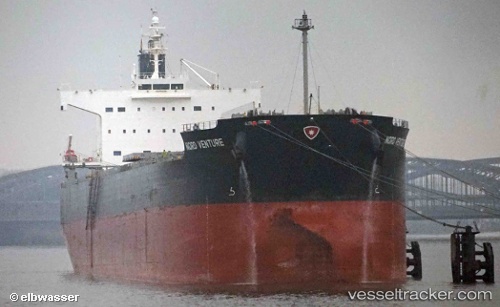
 NEA TYHI
Current Status
Where is the vessel?
NEA TYHI is currently in Near Tampines, based on AIS data received about 14h ago.
Latest AIS update:
Current position: 1.27772° N, 103.93547° E (Near Tampines)
Average speed (last 7 days): Loading…
Average speed (last 30 days): Loading…
Vessel profile: NEA TYHI is a Bulk Carrier with dimensions m x m.
This page combines live AIS, route history, probable destination signals, nearby traffic, and port activity for practical vessel monitoring.
The current position of vessel NEA TYHI is 1.27772 lat / 103.93547 lng. Updated: 2026-05-18 14:20:09 UTCNearest reference points:
- Near Tampines
- Near Changi
- Near Choa Chu Kang
Currently sailing under the flag of Greece ![]()
Details:
Live Vessel NEA TYHI Analytics (details, animations, etc.)
Recent AIS points (UTC):
2026-05-18 10:23:14 UTC · 1.27730, 103.93564 · SOG 0 kn · COG 62°2026-05-18 11:29:12 UTC · 1.27770, 103.93540 · SOG 0 kn · COG 85°
2026-05-18 13:23:11 UTC · 1.27721, 103.93557 · SOG 0.1 kn · COG 61°
2026-05-18 14:20:09 UTC · 1.27772, 103.93547 · SOG 0 kn · COG 71°