 Sunny Sky
Current Status
Where is the vessel?
Sunny Sky is currently in 24 nm N of Yantai, based on AIS data received about 14h ago.
Latest AIS update:
Current position: 37.95352° N, 121.45461° E (24 nm N of Yantai)
Average speed (last 7 days): Loading…
Average speed (last 30 days): Loading…
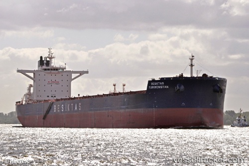
Vessel profile: Sunny Sky is a Bulk Carrier with dimensions 292m x 45m.
This page combines live AIS, route history, probable destination signals, nearby traffic, and port activity for practical vessel monitoring.
The current position of vessel Sunny Sky is 37.95352 lat / 121.45461 lng. Updated: 2026-05-23 07:20:08 UTCNearest reference points:
- 18 nm N of Yantai Pt
- 29 nm S of Lushun New Pt
- Near Yantai
Currently sailing under the flag of Panama ![]()
Sunny Sky built in 2011 year
Deadweight:
179797 tDetails:
Live Vessel Sunny Sky Analytics (details, animations, etc.)
Recent AIS points (UTC):
2026-05-23 03:51:25 UTC · 37.95042, 121.46026 · SOG 0.1 kn · COG 320°2026-05-23 06:00:27 UTC · 37.95202, 121.45502 · SOG 0.2 kn · COG 76°
2026-05-23 07:03:29 UTC · 37.95313, 121.45491 · SOG 0.1 kn · COG 99°
2026-05-23 07:20:08 UTC · 37.95352, 121.45461 · SOG 0.1 kn · COG -1°