 Maliakos
Current Status
Where is the vessel?
Maliakos is currently in 60 nm W of Ancud, based on AIS data received about 14h ago.
Latest AIS update:
Current position: 42.17156° S, 75.11828° W (60 nm W of Ancud)
Average speed (last 7 days): Loading…
Average speed (last 30 days): Loading…
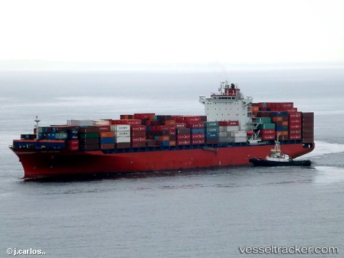
Vessel profile: Maliakos is a Container Ship with dimensions 262m x 32m.
This page combines live AIS, route history, probable destination signals, nearby traffic, and port activity for practical vessel monitoring.
The current position of vessel Maliakos is -42.17156 lat / -75.11828 lng. Updated: 2026-05-22 02:12:13 UTCNearest reference points:
- Near Chonchi
- Near Quellón (Puerto Quellón)
- Near Melinka
Currently sailing under the flag of Liberia ![]()
Maliakos built in 2012 year
Deadweight:
51310 tDetails:
Live Vessel Maliakos Analytics (details, animations, etc.)
Recent AIS points (UTC):
2026-05-21 21:40:49 UTC · -43.25876, -75.32727 · SOG 14.6 kn · COG 4°2026-05-21 22:03:08 UTC · -43.16943, -75.31053 · SOG 14.5 kn · COG 4°
2026-05-22 02:10:19 UTC · -42.17912, -75.11990 · SOG 14.5 kn · COG 6°
2026-05-22 02:12:13 UTC · -42.17156, -75.11828 · SOG 14.7 kn · COG 6°