 vesseltracker.com
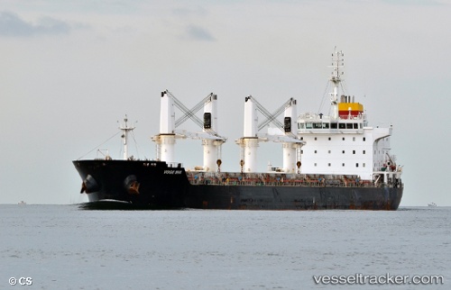
 LYNX
LYNX
Current Status
Where is the vessel?
LYNX is currently in 108 nm W of Navarino Bay, based on AIS data received about 15h ago.
Latest AIS update:
Current position: 36.31833° N, 19.55500° E (108 nm W of Navarino Bay)
Average speed (last 7 days): Loading…
Average speed (last 30 days): Loading…
Vessel profile: LYNX is a Bulk Carrier with dimensions m x m.
This page combines live AIS, route history, probable destination signals, nearby traffic, and port activity for practical vessel monitoring.
The current position of vessel LYNX is 36.31833 lat / 19.55500 lng. Updated: 2026-05-18 01:40:05 UTCNearest reference points:
- 103 nm NE of Ryuo
- 71 nm N of Pinelands
- 73 nm N of Pinelands
Currently sailing under the flag of Marshall Islands ![]()
Details:
Live Vessel LYNX Analytics (details, animations, etc.)
Recent AIS points (UTC):
2026-05-17 22:52:02 UTC · 36.30667, 20.14833 · SOG 9 kn · COG -1°2026-05-17 23:34:03 UTC · 36.30500, 20.00333 · SOG 10 kn · COG -1°
2026-05-18 01:40:05 UTC · 36.31833, 19.55500 · SOG 10 kn · COG -1°
2026-05-18 01:40:05 UTC · 36.31833, 19.55500 · SOG 10 kn · COG -1°