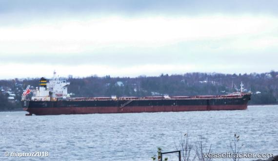
 Amalfi
Current Status
Where is the vessel?
Amalfi is currently in 25 nm N of AIRLIE, based on AIS data received about 14h ago.
Latest AIS update:
Current position: 19.84767° S, 148.69012° E (25 nm N of AIRLIE)
Average speed (last 7 days): Loading…
Average speed (last 30 days): Loading…
Vessel profile: Amalfi is a Bulk Carrier with dimensions 224m x 32m.
This page combines live AIS, route history, probable destination signals, nearby traffic, and port activity for practical vessel monitoring.
The current position of vessel Amalfi is -19.84767 lat / 148.69012 lng. Updated: 2026-05-18 22:09:12 UTCNearest reference points:
- Near AIRLIE
- Near Abell Point
- Near Whitsunday Island
Currently sailing under the flag of Malta ![]()
Amalfi built in 2009 year
Deadweight:
75206 tDetails:
Live Vessel Amalfi Analytics (details, animations, etc.)
Recent AIS points (UTC):
2026-05-18 19:05:26 UTC · -19.56167, 148.07365 · SOG 12.5 kn · COG 114°2026-05-18 19:23:22 UTC · -19.58566, 148.13528 · SOG 12.5 kn · COG 115°
2026-05-18 21:53:31 UTC · -19.81926, 148.63757 · SOG 12.9 kn · COG 120°
2026-05-18 22:09:12 UTC · -19.84767, 148.69012 · SOG 13.1 kn · COG 120°