Warta
Current StatusWhere is the vessel?
Warta is currently in 43 nm SW of Kiamari, based on AIS data received about 15h ago.
Latest AIS update:
Current position: 24.28233° N, 66.43524° E (43 nm SW of Kiamari)
Average speed (last 7 days): Loading…
Average speed (last 30 days): Loading…
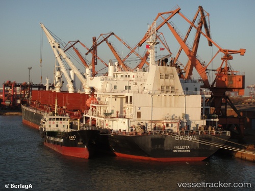
Vessel profile: Warta is a Bulk Carrier with dimensions 31m x 189m.
This page combines live AIS, route history, probable destination signals, nearby traffic, and port activity for practical vessel monitoring.
The current position of vessel Warta is 24.28233 lat / 66.43524 lng. Updated: 2026-05-20 04:43:26 UTCNearest reference points:
- 16 nm S of Kiamari
- Near Kiamari
- 84 nm SW of Keti Bandar
Details:
Live Vessel Warta Analytics (details, animations, etc.)
Recent AIS points (UTC):
2026-05-20 00:45:54 UTC · 24.28182, 66.43554 · SOG 0.2 kn · COG -1°2026-05-20 02:01:05 UTC · 24.28212, 66.43547 · SOG 0.2 kn · COG -1°
2026-05-20 03:10:23 UTC · 24.28243, 66.43525 · SOG 0.1 kn · COG 243°
2026-05-20 04:43:26 UTC · 24.28233, 66.43524 · SOG 0.1 kn · COG 247°