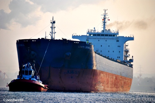
 NESTOR S
Current Status
Where is the vessel?
NESTOR S is currently in 129 nm SW of Kaohsiung, based on AIS data received about 1d ago.
Latest AIS update:
Current position: 20.61208° N, 119.32206° E (129 nm SW of Kaohsiung)
Average speed (last 7 days): Loading…
Average speed (last 30 days): Loading…
Vessel profile: NESTOR S is a Bulk Carrier with dimensions m x m.
This page combines live AIS, route history, probable destination signals, nearby traffic, and port activity for practical vessel monitoring.
The current position of vessel NESTOR S is 20.61208 lat / 119.32206 lng. Updated: 2026-05-22 10:59:40 UTCNearest reference points:
- 132 nm SW of Kaohsiung
- 101 nm S of Kaohsiung
- 106 nm W of Basco
Currently sailing under the flag of Greece ![]()
Details:
Live Vessel NESTOR S Analytics (details, animations, etc.)
Recent AIS points (UTC):
2026-05-22 10:59:40 UTC · 20.61208, 119.32206 · SOG 12 kn · COG -1°2026-05-22 10:59:40 UTC · 20.61208, 119.32206 · SOG 12 kn · COG -1°
2026-05-22 10:59:40 UTC · 20.61208, 119.32206 · SOG 12 kn · COG -1°
2026-05-22 10:59:40 UTC · 20.61208, 119.32206 · SOG 12 kn · COG -1°