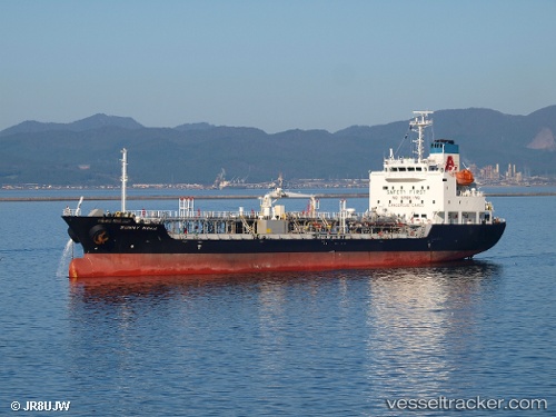
Sunny Noah
Current StatusWhere is the vessel?
Sunny Noah is currently in 22 nm SW of Minachi, based on AIS data received about 14h ago.
Latest AIS update:
Current position: 33.51375° N, 135.43065° E (22 nm SW of Minachi)
Average speed (last 7 days): Loading…
Average speed (last 30 days): Loading…
Vessel profile: Sunny Noah is a Chemical Oil Products Tanker with dimensions 17m x 110m.
This page combines live AIS, route history, probable destination signals, nearby traffic, and port activity for practical vessel monitoring.
The current position of vessel Sunny Noah is 33.51375 lat / 135.43065 lng. Updated: 2026-05-19 13:04:53 UTCNearest reference points:
- 18 nm SE of Gobo Wakayama
- 12 nm S of Gobo Wakayama
- 40 nm SW of Minachi
Details:
Live Vessel Sunny Noah Analytics (details, animations, etc.)
Recent AIS points (UTC):
2026-05-19 09:35:55 UTC · 33.66965, 136.17752 · SOG 13.4 kn · COG 224°2026-05-19 10:44:09 UTC · 33.49333, 135.94946 · SOG 13.6 kn · COG 224°
2026-05-19 10:44:09 UTC · 33.49333, 135.94946 · SOG 13.6 kn · COG 224°
2026-05-19 13:04:53 UTC · 33.51375, 135.43065 · SOG 12.8 kn · COG 290°