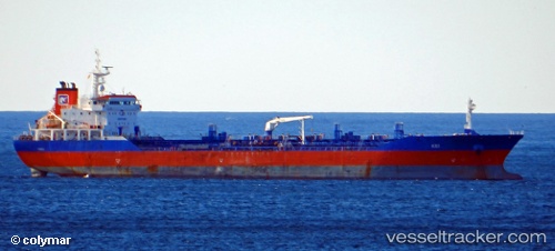
Kei
Current StatusWhere is the vessel?
Kei is currently in 66 nm NW of Margomulyo, based on AIS data received about 14h ago.
Latest AIS update:
Current position: 1.44500° N, 121.12167° E (66 nm NW of Margomulyo)
Average speed (last 7 days): Loading…
Average speed (last 30 days): Loading…
Vessel profile: Kei is a Oil Products Tanker with dimensions 24m x 144m.
This page combines live AIS, route history, probable destination signals, nearby traffic, and port activity for practical vessel monitoring.
The current position of vessel Kei is 1.44500 lat / 121.12167 lng. Updated: 2026-05-19 09:32:38 UTCNearest reference points:
- 41 nm SW of Margomulyo
- 81 nm E of Muara Pantai
- 29 nm W of Labuanbajo
Details:
Live Vessel Kei Analytics (details, animations, etc.)
Recent AIS points (UTC):
2026-05-19 05:20:38 UTC · 1.22167, 120.45333 · SOG 10 kn · COG -1°2026-05-19 06:59:39 UTC · 1.36667, 120.70167 · SOG 9 kn · COG -1°
2026-05-19 07:53:38 UTC · 1.41333, 120.85333 · SOG 10 kn · COG -1°
2026-05-19 09:32:38 UTC · 1.44500, 121.12167 · SOG 9 kn · COG -1°