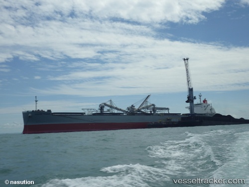
Corona Power
Current StatusWhere is the vessel?
Corona Power is currently in 24 nm E of YAMBA, based on AIS data received about 14h ago.
Latest AIS update:
Current position: 29.45743° S, 153.80180° E (24 nm E of YAMBA)
Average speed (last 7 days): Loading…
Average speed (last 30 days): Loading…
Vessel profile: Corona Power is a Bulk Carrier with dimensions 37m x 228m.
This page combines live AIS, route history, probable destination signals, nearby traffic, and port activity for practical vessel monitoring.
The current position of vessel Corona Power is -29.45743 lat / 153.80180 lng. Updated: 2026-05-19 13:53:17 UTCNearest reference points:
- Near Gold Coast
- Near Labrador
- Near Biggera Waters
Details:
Live Vessel Corona Power Analytics (details, animations, etc.)
Recent AIS points (UTC):
2026-05-19 10:37:38 UTC · -29.92979, 153.67900 · SOG 8.7 kn · COG 17°2026-05-19 11:39:34 UTC · -29.78333, 153.72166 · SOG 8 kn · COG -1°
2026-05-19 13:50:35 UTC · -29.46433, 153.80049 · SOG 9.5 kn · COG 11°
2026-05-19 13:53:17 UTC · -29.45743, 153.80180 · SOG 9.1 kn · COG 11°