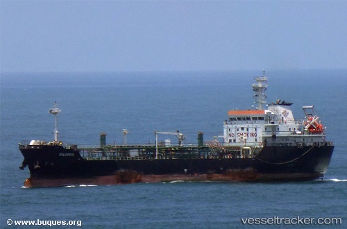
 FILIPPA
Current Status
Where is the vessel?
FILIPPA is currently in Near Punta Cardón, based on AIS data received about 15h ago.
Latest AIS update:
Current position: 11.66333° N, 70.23833° W (Near Punta Cardón)
Average speed (last 7 days): Loading…
Average speed (last 30 days): Loading…
Vessel profile: FILIPPA is a Tanker with dimensions m x m.
This page combines live AIS, route history, probable destination signals, nearby traffic, and port activity for practical vessel monitoring.
The current position of vessel FILIPPA is 11.66333 lat / -70.23833 lng. Updated: 2026-05-22 12:00:50 UTCNearest reference points:
- Near Las Piedras
- Near Bullenbaai
- 24 nm NW of Palm Beach
Details:
Live Vessel FILIPPA Analytics (details, animations, etc.)
Recent AIS points (UTC):
2026-05-22 07:51:51 UTC · 11.66333, -70.23833 · SOG 0 kn · COG -1°2026-05-22 09:59:42 UTC · 11.66470, -70.23918 · SOG 0 kn · COG 85°
2026-05-22 10:17:43 UTC · 11.66469, -70.23920 · SOG 0 kn · COG 85°
2026-05-22 12:00:50 UTC · 11.66333, -70.23833 · SOG 0 kn · COG -1°