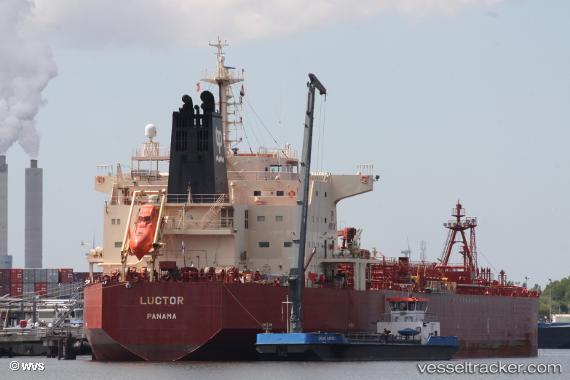
 LUCTOR
Current Status
Where is the vessel?
LUCTOR is currently in 49 nm W of Gombong, based on AIS data received about 14h ago.
Latest AIS update:
Current position: 7.35667° N, 107.30667° E (49 nm W of Gombong)
Average speed (last 7 days): Loading…
Average speed (last 30 days): Loading…
Vessel profile: LUCTOR is a Oil/Chemical Tanker with dimensions m x m.
This page combines live AIS, route history, probable destination signals, nearby traffic, and port activity for practical vessel monitoring.
The current position of vessel LUCTOR is 7.35667 lat / 107.30667 lng. Updated: 2026-05-20 14:21:48 UTCNearest reference points:
- 11 nm N of Gombong
- 30 nm SW of Dai Hung (Tandem Load)
- 50 nm SW of Ben Dam Con Dao Terminals
Currently sailing under the flag of Panama ![]()
Details:
Live Vessel LUCTOR Analytics (details, animations, etc.)
Recent AIS points (UTC):
2026-05-20 10:43:31 UTC · 7.87378, 107.76810 · SOG 11.3 kn · COG 221°2026-05-20 12:07:10 UTC · 7.67995, 107.58788 · SOG 11.4 kn · COG 213°
2026-05-20 12:51:59 UTC · 7.56675, 107.50174 · SOG 11.5 kn · COG 215°
2026-05-20 14:21:48 UTC · 7.35667, 107.30667 · SOG 11 kn · COG -1°