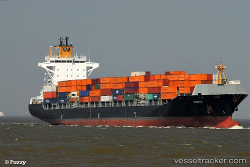
 Porto
Porto
Current Status
Where is the vessel?
Porto is currently in 122 nm NE of Dokdo, based on AIS data received about 14h ago.
Latest AIS update:
Current position: 38.49667° N, 133.86166° E (122 nm NE of Dokdo)
Average speed (last 7 days): Loading…
Average speed (last 30 days): Loading…
Vessel profile: Porto is a Container Ship with dimensions 225m x 30m.
This page combines live AIS, route history, probable destination signals, nearby traffic, and port activity for practical vessel monitoring.
The current position of vessel Porto is 38.49667 lat / 133.86166 lng. Updated: 2026-05-23 01:43:28 UTCNearest reference points:
- 82 nm NE of Dokdo
- 80 nm NE of Dokdo
- 94 nm N of Dokdo
Currently sailing under the flag of Liberia ![]()
Porto built in 2010 year
Deadweight:
39267 tDetails:
Live Vessel Porto Analytics (details, animations, etc.)
Recent AIS points (UTC):
2026-05-22 22:46:18 UTC · 37.65392, 133.25258 · SOG 19.6 kn · COG 36°2026-05-23 00:01:19 UTC · 38.00955, 133.50621 · SOG 19.8 kn · COG 31°
2026-05-23 00:42:13 UTC · 38.20370, 133.64783 · SOG 19.5 kn · COG 34°
2026-05-23 01:43:28 UTC · 38.49667, 133.86166 · SOG 20 kn · COG -1°