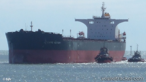
Cape Victory
Current StatusWhere is the vessel?
Cape Victory is currently in 44 nm N of Tami Island, based on AIS data received about 14h ago.
Latest AIS update:
Current position: 6.04008° S, 147.79138° E (44 nm N of Tami Island)
Average speed (last 7 days): Loading…
Average speed (last 30 days): Loading…
Vessel profile: Cape Victory is a Bulk Carrier with dimensions 45m x 290m.
This page combines live AIS, route history, probable destination signals, nearby traffic, and port activity for practical vessel monitoring.
The current position of vessel Cape Victory is -6.04008 lat / 147.79138 lng. Updated: 2026-05-22 23:40:40 UTCNearest reference points:
- 42 nm E of Tami Island
- Near Lae
Details:
Live Vessel Cape Victory Analytics (details, animations, etc.)
Recent AIS points (UTC):
2026-05-22 19:27:22 UTC · -5.41333, 147.42500 · SOG 11 kn · COG -1°2026-05-22 22:03:00 UTC · -5.83618, 147.63992 · SOG 9.2 kn · COG 146°
2026-05-22 22:51:22 UTC · -5.94500, 147.70332 · SOG 9 kn · COG -1°
2026-05-22 23:40:40 UTC · -6.04008, 147.79138 · SOG 9.6 kn · COG 122°