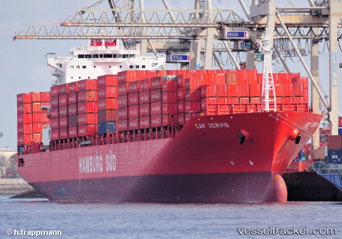
 Cap Jervis
Current Status
Where is the vessel?
Cap Jervis is currently in 64 nm NE of PENGERANG, based on AIS data received about 14h ago.
Latest AIS update:
Current position: 2.05480° N, 104.94788° E (64 nm NE of PENGERANG)
Average speed (last 7 days): Loading…
Average speed (last 30 days): Loading…
Vessel profile: Cap Jervis is a Container Ship with dimensions 264m x 32m.
This page combines live AIS, route history, probable destination signals, nearby traffic, and port activity for practical vessel monitoring.
The current position of vessel Cap Jervis is 2.05480 lat / 104.94788 lng. Updated: 2026-05-22 02:28:01 UTCNearest reference points:
- 55 nm NE of PENGERANG
- 64 nm NE of PENGERANG
- 53 nm NE of PENGERANG
Currently sailing under the flag of Singapore ![]()
Cap Jervis built in 2010 year
Deadweight:
59266 tDetails:
Live Vessel Cap Jervis Analytics (details, animations, etc.)
Recent AIS points (UTC):
2026-05-21 21:47:42 UTC · 1.19123, 103.83368 · SOG 8.6 kn · COG 138°2026-05-21 23:11:19 UTC · 1.25646, 104.20987 · SOG 21.3 kn · COG 81°
2026-05-22 01:17:07 UTC · 1.66436, 104.80083 · SOG 21.2 kn · COG 32°
2026-05-22 02:28:01 UTC · 2.05480, 104.94788 · SOG 20.9 kn · COG 19°