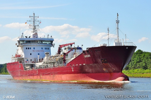
 KATELINA
Current Status
Where is the vessel?
KATELINA is currently in Near Milford Haven, based on AIS data received about 14h ago.
Latest AIS update:
Current position: 51.69842° N, 5.02393° W (Near Milford Haven)
Average speed (last 7 days): Loading…
Average speed (last 30 days): Loading…
Vessel profile: KATELINA is a Tanker with dimensions m x m.
This page combines live AIS, route history, probable destination signals, nearby traffic, and port activity for practical vessel monitoring.
The current position of vessel KATELINA is 51.69842 lat / -5.02393 lng. Updated: 2026-05-19 05:43:43 UTCNearest reference points:
- Near Black Pill
- Near Landore
- 10 nm NW of Grampound
Currently sailing under the flag of Portugal ![]()
Details:
Live Vessel KATELINA Analytics (details, animations, etc.)
Recent AIS points (UTC):
2026-05-19 01:31:44 UTC · 51.69827, -5.02387 · SOG 0 kn · COG 269°2026-05-19 03:46:49 UTC · 51.69834, -5.02404 · SOG 0 kn · COG 269°
2026-05-19 04:55:45 UTC · 51.69830, -5.02399 · SOG 0 kn · COG 269°
2026-05-19 05:43:43 UTC · 51.69842, -5.02393 · SOG 0 kn · COG 269°