 vesseltracker.com
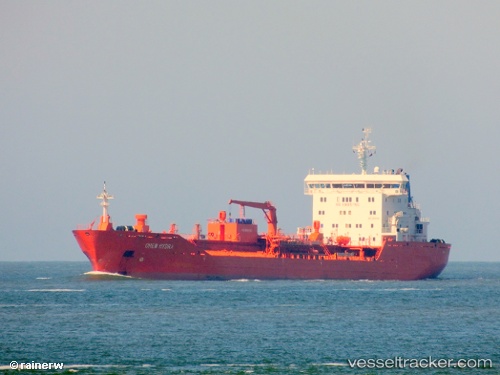
 Chem Hydra
Current Status
Where is the vessel?
Chem Hydra is currently in 16 nm SE of Sheppard, based on AIS data received about 14h ago.
Latest AIS update:
Current position: 29.07521° N, 94.63913° W (16 nm SE of Sheppard)
Average speed (last 7 days): Loading…
Average speed (last 30 days): Loading…
Vessel profile: Chem Hydra is a Chemical Oil Products Tanker with dimensions 144m x 24m.
This page combines live AIS, route history, probable destination signals, nearby traffic, and port activity for practical vessel monitoring.
The current position of vessel Chem Hydra is 29.07521 lat / -94.63913 lng. Updated: 2026-05-18 04:03:59 UTCNearest reference points:
- 12 nm SE of Port Bolivar
- Near Port Bolivar
- Near Texas City
Currently sailing under the flag of Liberia ![]()
Chem Hydra built in 2009 year
Deadweight:
17055 tDetails:
Live Vessel Chem Hydra Analytics (details, animations, etc.)
Recent AIS points (UTC):
2026-05-17 22:35:14 UTC · 29.08414, -94.66422 · SOG 0.4 kn · COG 96°2026-05-18 00:21:52 UTC · 29.07810, -94.69050 · SOG 1.4 kn · COG 54°
2026-05-18 01:45:54 UTC · 29.07452, -94.63938 · SOG 0.3 kn · COG 113°
2026-05-18 04:03:59 UTC · 29.07521, -94.63913 · SOG 0.2 kn · COG 124°