 PARDUS
Current Status
Where is the vessel?
PARDUS is currently in 188 nm NE of La Désirade, based on AIS data received about 15h ago.
Latest AIS update:
Current position: 18.18990° N, 58.45820° W (188 nm NE of La Désirade)
Average speed (last 7 days): Loading…
Average speed (last 30 days): Loading…
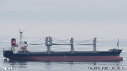
Vessel profile: PARDUS is a Bulk Carrier with dimensions m x m.
This page combines live AIS, route history, probable destination signals, nearby traffic, and port activity for practical vessel monitoring.
The current position of vessel PARDUS is 18.18990 lat / -58.45820 lng. Updated: 2026-05-19 07:27:17 UTCNearest reference points:
- 267 nm E of La Désirade
- 314 nm NE of La Désirade
Currently sailing under the flag of Barbados ![]()
Details:
Live Vessel PARDUS Analytics (details, animations, etc.)
Recent AIS points (UTC):
2026-05-19 04:10:03 UTC · 18.60141, -57.92312 · SOG 11.9 kn · COG 230°2026-05-19 05:26:13 UTC · 18.44512, -58.13436 · SOG 11.9 kn · COG 232°
2026-05-19 07:21:26 UTC · 18.20271, -58.44305 · SOG 12 kn · COG 228°
2026-05-19 07:27:17 UTC · 18.18990, -58.45820 · SOG 11.8 kn · COG 228°