 NORMA
NORMA
Current Status
Where is the vessel?
NORMA is currently in Near Ha Long, based on AIS data received about 14h ago.
Latest AIS update:
Current position: 20.86215° N, 107.11857° E (Near Ha Long)
Average speed (last 7 days): Loading…
Average speed (last 30 days): Loading…
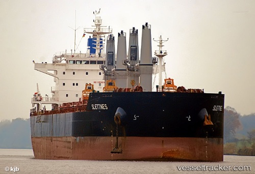
Vessel profile: NORMA is a Bulk Carrier with dimensions 190m x 32m.
This page combines live AIS, route history, probable destination signals, nearby traffic, and port activity for practical vessel monitoring.
The current position of vessel NORMA is 20.86215 lat / 107.11857 lng. Updated: 2026-05-20 05:54:56 UTCNearest reference points:
- 14 nm SE of Nam Hai Dinh Vu Port
- 12 nm SE of Nam Hai Dinh Vu Port
- 18 nm SE of Ha Long
Currently sailing under the flag of Liberia ![]()
NORMA built in 2010 year
Deadweight:
58018 tDetails:
Live Vessel NORMA Analytics (details, animations, etc.)
Recent AIS points (UTC):
2026-05-20 02:08:44 UTC · 20.86068, 107.12148 · SOG 0 kn · COG 263°2026-05-20 03:34:43 UTC · 20.86187, 107.11881 · SOG 0 kn · COG -1°
2026-05-20 04:05:47 UTC · 20.86185, 107.11880 · SOG 0 kn · COG 126°
2026-05-20 05:54:56 UTC · 20.86215, 107.11857 · SOG 0 kn · COG -1°