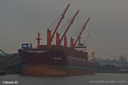
 KIRAN EUROPE
Current Status
Where is the vessel?
KIRAN EUROPE is currently in 66 nm N of Hamra, based on AIS data received about 14h ago.
Latest AIS update:
Current position: 32.08001° N, 28.98664° E (66 nm N of Hamra)
Average speed (last 7 days): Loading…
Average speed (last 30 days): Loading…
Vessel profile: KIRAN EUROPE is a Bulk Carrier with dimensions m x m.
This page combines live AIS, route history, probable destination signals, nearby traffic, and port activity for practical vessel monitoring.
The current position of vessel KIRAN EUROPE is 32.08001 lat / 28.98664 lng. Updated: 2026-05-19 10:08:51 UTCNearest reference points:
- 28 nm N of Hamra
- Near EL DEKHEILA
- 13 nm W of EL DEKHEILA
Currently sailing under the flag of Turkey ![]()
Details:
Live Vessel KIRAN EUROPE Analytics (details, animations, etc.)
Recent AIS points (UTC):
2026-05-19 07:03:39 UTC · 32.07868, 28.93991 · SOG 0.8 kn · COG 314°2026-05-19 08:21:00 UTC · 32.08013, 28.95824 · SOG 0.9 kn · COG 55°
2026-05-19 10:05:51 UTC · 32.08006, 28.98584 · SOG 0.7 kn · COG 54°
2026-05-19 10:08:51 UTC · 32.08001, 28.98664 · SOG 0.6 kn · COG 54°