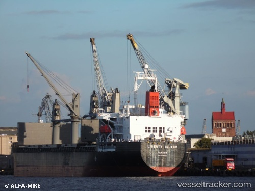
 Liberty Island
Current Status
Where is the vessel?
Liberty Island is currently in 13 nm NW of Free Port, based on AIS data received about 1d ago.
Latest AIS update:
Current position: 25.41915° N, 55.09616° E (13 nm NW of Free Port)
Average speed (last 7 days): Loading…
Average speed (last 30 days): Loading…
Vessel profile: Liberty Island is a Bulk Carrier with dimensions 178m x 178m.
This page combines live AIS, route history, probable destination signals, nearby traffic, and port activity for practical vessel monitoring.
The current position of vessel Liberty Island is 25.41915 lat / 55.09616 lng. Updated: 2026-05-19 14:16:29 UTCNearest reference points:
- Near Free Port
- 17 nm NW of Free Port
- Near DUBAI
Currently sailing under the flag of Panama ![]()
Liberty Island built in 2011 year
Deadweight:
37218 tDetails:
Live Vessel Liberty Island Analytics (details, animations, etc.)
Recent AIS points (UTC):
2026-05-19 14:16:29 UTC · 25.41915, 55.09616 · SOG 1.7 kn · COG -1°2026-05-19 14:16:29 UTC · 25.41915, 55.09616 · SOG 1.7 kn · COG -1°
2026-05-19 14:16:29 UTC · 25.41915, 55.09616 · SOG 1.7 kn · COG -1°
2026-05-19 14:16:29 UTC · 25.41915, 55.09616 · SOG 1.7 kn · COG -1°