 vesseltracker.com
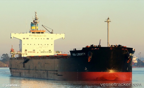
 VOSPOROS
Current Status
Where is the vessel?
VOSPOROS is currently in Near Astoria, based on AIS data received about 14h ago.
Latest AIS update:
Current position: 46.21437° N, 123.78611° W (Near Astoria)
Average speed (last 7 days): Loading…
Average speed (last 30 days): Loading…
Vessel profile: VOSPOROS is a Bulk Carrier with dimensions m x m.
This page combines live AIS, route history, probable destination signals, nearby traffic, and port activity for practical vessel monitoring.
The current position of vessel VOSPOROS is 46.21437 lat / -123.78611 lng. Updated: 2026-05-18 07:46:52 UTCNearest reference points:
- Near Astoria
- Near WARRENTON
- Near Grays River
Currently sailing under the flag of Bahamas ![]()
Details:
Live Vessel VOSPOROS Analytics (details, animations, etc.)
Recent AIS points (UTC):
2026-05-18 04:04:31 UTC · 46.21337, -123.79170 · SOG 0 kn · COG 58°2026-05-18 05:28:28 UTC · 46.21333, -123.78500 · SOG 0 kn · COG -1°
2026-05-18 07:31:37 UTC · 46.21437, -123.78615 · SOG 0 kn · COG 260°
2026-05-18 07:46:52 UTC · 46.21437, -123.78611 · SOG 0 kn · COG 259°