 PRINCESS ERIN
Current Status
Where is the vessel?
PRINCESS ERIN is currently in Near Kiziltoprak, based on AIS data received about 14h ago.
Latest AIS update:
Current position: 40.92372° N, 28.99250° E (Near Kiziltoprak)
Average speed (last 7 days): Loading…
Average speed (last 30 days): Loading…
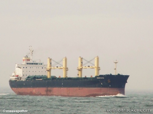
Vessel profile: PRINCESS ERIN is a Bulk Carrier with dimensions 32m x 190m.
This page combines live AIS, route history, probable destination signals, nearby traffic, and port activity for practical vessel monitoring.
The current position of vessel PRINCESS ERIN is 40.92372 lat / 28.99250 lng. Updated: 2026-05-19 05:51:46 UTCNearest reference points:
- Near ZEYTINBURNU
- Near Kiziltoprak
- Near Maltepe
Currently sailing under the flag of Marshall Islands ![]()
PRINCESS ERIN built in 2011 year
Deadweight:
57334 tDetails:
Live Vessel PRINCESS ERIN Analytics (details, animations, etc.)
Recent AIS points (UTC):
2026-05-19 01:36:26 UTC · 40.76178, 28.98878 · SOG 0.2 kn · COG 277°2026-05-19 03:48:06 UTC · 40.76940, 28.98553 · SOG 0.2 kn · COG 55°
2026-05-19 04:32:26 UTC · 40.77090, 28.98603 · SOG 0.1 kn · COG 87°
2026-05-19 05:51:46 UTC · 40.92372, 28.99250 · SOG 9 kn · COG 341°