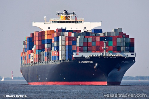
Seroja Tiga
Current StatusWhere is the vessel?
Seroja Tiga is currently in 196 nm NE of Coral Sea, based on AIS data received about 14h ago.
Latest AIS update:
Current position: 16.60089° S, 153.12167° E (196 nm NE of Coral Sea)
Average speed (last 7 days): Loading…
Average speed (last 30 days): Loading…
Vessel profile: Seroja Tiga is a Container Ship with dimensions 46m x 316m.
This page combines live AIS, route history, probable destination signals, nearby traffic, and port activity for practical vessel monitoring.
The current position of vessel Seroja Tiga is -16.60089 lat / 153.12167 lng. Updated: 2026-05-21 11:44:18 UTCNearest reference points:
- 153 nm NE of Coral Sea
- 209 nm N of Coral Sea
Details:
Live Vessel Seroja Tiga Analytics (details, animations, etc.)
Recent AIS points (UTC):
2026-05-21 08:15:59 UTC · -17.67833, 153.34666 · SOG 18 kn · COG -1°2026-05-21 10:23:04 UTC · -17.02104, 153.20735 · SOG 18.9 kn · COG 349°
2026-05-21 10:27:59 UTC · -16.99500, 153.20166 · SOG 18 kn · COG -1°
2026-05-21 11:44:18 UTC · -16.60089, 153.12167 · SOG 18.8 kn · COG 349°