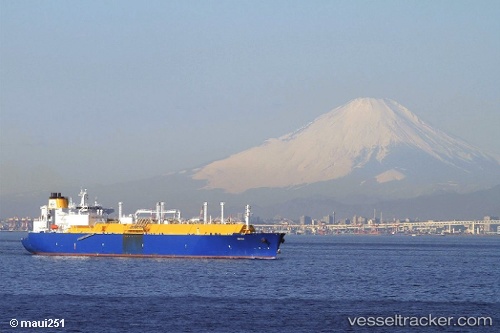
Amali
Current StatusWhere is the vessel?
Amali is currently in 13 nm W of Tutong, based on AIS data received about 14h ago.
Latest AIS update:
Current position: 4.76328° N, 114.44335° E (13 nm W of Tutong)
Average speed (last 7 days): Loading…
Average speed (last 30 days): Loading…
Vessel profile: Amali is a Lng Tanker with dimensions 44m x 284m.
This page combines live AIS, route history, probable destination signals, nearby traffic, and port activity for practical vessel monitoring.
The current position of vessel Amali is 4.76328 lat / 114.44335 lng. Updated: 2026-05-22 10:24:42 UTCNearest reference points:
- 11 nm N of MIRI
- Near MIRI
- Near Kikeh
Details:
Live Vessel Amali Analytics (details, animations, etc.)
Recent AIS points (UTC):
2026-05-22 07:36:50 UTC · 4.76253, 114.44322 · SOG 0 kn · COG -1°2026-05-22 08:24:05 UTC · 4.76286, 114.44334 · SOG 0 kn · COG -1°
2026-05-22 10:04:41 UTC · 4.76328, 114.44337 · SOG 0 kn · COG -1°
2026-05-22 10:24:42 UTC · 4.76328, 114.44335 · SOG 0 kn · COG -1°