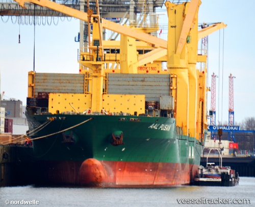
Aal Pusan
Current StatusWhere is the vessel?
Aal Pusan is currently in 17 nm SW of Banting, based on AIS data received about 14h ago.
Latest AIS update:
Current position: 2.64356° N, 101.25468° E (17 nm SW of Banting)
Average speed (last 7 days): Loading…
Average speed (last 30 days): Loading…
Vessel profile: Aal Pusan is a Multi Purpose Carrier with dimensions 29m x 194m.
This page combines live AIS, route history, probable destination signals, nearby traffic, and port activity for practical vessel monitoring.
The current position of vessel Aal Pusan is 2.64356 lat / 101.25468 lng. Updated: 2026-05-22 19:37:57 UTCNearest reference points:
- 15 nm SW of Banting
- 14 nm SW of Banting
- Near Pulau Indah
Details:
Live Vessel Aal Pusan Analytics (details, animations, etc.)
Recent AIS points (UTC):
2026-05-22 16:07:15 UTC · 3.15432, 100.59100 · SOG 14.6 kn · COG 128°2026-05-22 18:22:20 UTC · 2.80136, 100.99871 · SOG 14.4 kn · COG 122°
2026-05-22 19:32:52 UTC · 2.65531, 101.23823 · SOG 14.2 kn · COG 126°
2026-05-22 19:37:57 UTC · 2.64356, 101.25468 · SOG 14.2 kn · COG 126°