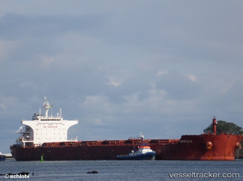
 MASTRO MICHAEL
Current Status
Where is the vessel?
MASTRO MICHAEL is currently in 139 nm NE of Tan Cang Qui Nhon, based on AIS data received about 23h ago.
Latest AIS update:
Current position: 15.50328° N, 111.42470° E (139 nm NE of Tan Cang Qui Nhon)
Average speed (last 7 days): Loading…
Average speed (last 30 days): Loading…
Vessel profile: MASTRO MICHAEL is a Bulk Carrier with dimensions m x m.
This page combines live AIS, route history, probable destination signals, nearby traffic, and port activity for practical vessel monitoring.
The current position of vessel MASTRO MICHAEL is 15.50328 lat / 111.42470 lng. Updated: 2026-05-22 09:58:17 UTCNearest reference points:
- 157 nm SE of Xincun
- 215 nm NE of Tan Cang Qui Nhon
- 17 nm NE of Bong Son
Currently sailing under the flag of Malta ![]()
Details:
Live Vessel MASTRO MICHAEL Analytics (details, animations, etc.)
Recent AIS points (UTC):
2026-05-22 09:58:17 UTC · 15.50328, 111.42470 · SOG 13.1 kn · COG 110°2026-05-22 09:58:17 UTC · 15.50328, 111.42470 · SOG 13.1 kn · COG 110°
2026-05-22 09:58:17 UTC · 15.50328, 111.42470 · SOG 13.1 kn · COG 110°
2026-05-22 09:58:17 UTC · 15.50328, 111.42470 · SOG 13.1 kn · COG 110°