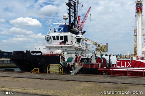
 Kamarina
Current Status
Where is the vessel?
Kamarina is currently in 24 nm NW of Leba, based on AIS data received about 14h ago.
Latest AIS update:
Current position: 54.97132° N, 16.98718° E (24 nm NW of Leba)
Average speed (last 7 days): Loading…
Average speed (last 30 days): Loading…
Vessel profile: Kamarina is a Tug with dimensions 50m x 15m.
This page combines live AIS, route history, probable destination signals, nearby traffic, and port activity for practical vessel monitoring.
The current position of vessel Kamarina is 54.97132 lat / 16.98718 lng. Updated: 2026-05-20 03:21:37 UTCNearest reference points:
- 31 nm NW of Ustka
- Near WLADYSLAWOWO
- Near Gdynia
Currently sailing under the flag of Italy ![]()
Kamarina built in 2010 year
Deadweight:
1268 tDetails:
Live Vessel Kamarina Analytics (details, animations, etc.)
Recent AIS points (UTC):
2026-05-20 01:03:18 UTC · 54.99143, 17.20981 · SOG 4.3 kn · COG 138°2026-05-20 02:04:06 UTC · 54.96778, 17.12083 · SOG 4.5 kn · COG 281°
2026-05-20 03:21:37 UTC · 54.97132, 16.98718 · SOG 6 kn · COG -1°
2026-05-20 03:21:37 UTC · 54.97132, 16.98718 · SOG 6 kn · COG -1°