 AAPUS 11
Current Status
Where is the vessel?
AAPUS 11 is currently in 14 nm S of Krieschow, based on AIS data received about 14h ago.
Latest AIS update:
Current position: 51.51225° N, 1.85622° E (14 nm S of Krieschow)
Average speed (last 7 days): Loading…
Average speed (last 30 days): Loading…
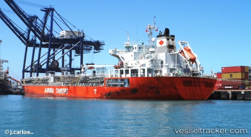
Vessel profile: AAPUS 11 is a Oil/Chemical Tanker with dimensions m x m.
This page combines live AIS, route history, probable destination signals, nearby traffic, and port activity for practical vessel monitoring.
The current position of vessel AAPUS 11 is 51.51225 lat / 1.85622 lng. Updated: 2026-05-20 01:06:36 UTCNearest reference points:
- 15 nm E of RAMSGATE
- 14 nm SE of RAMSGATE
- Near Broadstairs
Currently sailing under the flag of Panama ![]()
Details:
Live Vessel AAPUS 11 Analytics (details, animations, etc.)
Recent AIS points (UTC):
2026-05-19 21:39:37 UTC · 51.50863, 1.85400 · SOG 0 kn · COG 61°2026-05-19 22:48:35 UTC · 51.50883, 1.85412 · SOG 0 kn · COG 63°
2026-05-19 23:57:34 UTC · 51.51073, 1.85505 · SOG 0.5 kn · COG 136°
2026-05-20 01:06:36 UTC · 51.51225, 1.85622 · SOG 0.1 kn · COG 198°