 vesseltracker.com
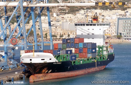
Atlantic Peach
Current StatusWhere is the vessel?
Atlantic Peach is currently in 31 nm W of Megadim, based on AIS data received about 6d ago.
Latest AIS update:
Current position: 32.90171° N, 34.37557° E (31 nm W of Megadim)
Average speed (last 7 days): Loading…
Average speed (last 30 days): Loading…
Vessel profile: Atlantic Peach is a Container Ship with dimensions 23m x 139m.
This page combines live AIS, route history, probable destination signals, nearby traffic, and port activity for practical vessel monitoring.
The current position of vessel Atlantic Peach is 32.90171 lat / 34.37557 lng. Updated: 2026-05-11 10:26:43 UTCNearest reference points:
- 22 nm W of Haifa Granaries
- Near Haifa
- 17 nm E of Atakka Dry Port
Details:
Live Vessel Atlantic Peach Analytics (details, animations, etc.)
Recent AIS points (UTC):
2026-05-11 10:26:43 UTC · 32.90171, 34.37557 · SOG 0 kn · COG 39°2026-05-11 10:26:43 UTC · 32.90171, 34.37557 · SOG 0 kn · COG 39°
2026-05-11 10:26:43 UTC · 32.90171, 34.37557 · SOG 0 kn · COG 39°
2026-05-11 10:26:43 UTC · 32.90171, 34.37557 · SOG 0 kn · COG 39°