 vesseltracker.com
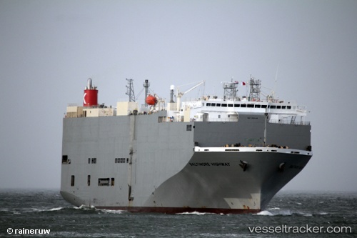
 Baltimore Highway
Current Status
Where is the vessel?
Baltimore Highway is currently in 40 nm S of San Andres Huaxpaltepec, based on AIS data received about 14h ago.
Latest AIS update:
Current position: 15.67994° N, 97.74502° W (40 nm S of San Andres Huaxpaltepec)
Average speed (last 7 days): Loading…
Average speed (last 30 days): Loading…
Vessel profile: Baltimore Highway is a Vehicles Carrier with dimensions 180m x 32m.
This page combines live AIS, route history, probable destination signals, nearby traffic, and port activity for practical vessel monitoring.
The current position of vessel Baltimore Highway is 15.67994 lat / -97.74502 lng. Updated: 2026-05-17 21:53:54 UTCNearest reference points:
- Near Acapulco
Currently sailing under the flag of Panama ![]()
Baltimore Highway built in 2009 year
Deadweight:
15341 tDetails:
Live Vessel Baltimore Highway Analytics (details, animations, etc.)
Recent AIS points (UTC):
2026-05-17 17:42:33 UTC · 16.06266, -98.80976 · SOG 15.6 kn · COG 112°2026-05-17 19:00:21 UTC · 15.94877, -98.48025 · SOG 15.8 kn · COG 110°
2026-05-17 19:37:51 UTC · 15.89202, -98.32044 · SOG 15.6 kn · COG 110°
2026-05-17 21:53:54 UTC · 15.67994, -97.74502 · SOG 15.9 kn · COG 111°