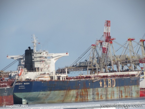
 CAPE SHANGRILA
Current Status
Where is the vessel?
CAPE SHANGRILA is currently in 304 nm NE of Windermere, based on AIS data received about 15h ago.
Latest AIS update:
Current position: 31.44657° S, 13.27527° W (304 nm NE of Windermere)
Average speed (last 7 days): Loading…
Average speed (last 30 days): Loading…
Vessel profile: CAPE SHANGRILA is a Bulk Carrier with dimensions m x m.
This page combines live AIS, route history, probable destination signals, nearby traffic, and port activity for practical vessel monitoring.
The current position of vessel CAPE SHANGRILA is -31.44657 lat / -13.27527 lng. Updated: 2026-05-22 19:05:12 UTCNearest reference points:
- Open sea, approx. 400 nm off the nearest listed port
- Open sea, approx. 401 nm off the nearest listed port
- Open sea, approx. 402 nm off the nearest listed port
Currently sailing under the flag of Marshall Islands ![]()
Details:
Live Vessel CAPE SHANGRILA Analytics (details, animations, etc.)
Recent AIS points (UTC):
2026-05-22 16:14:21 UTC · -31.31207, -13.83608 · SOG 10.6 kn · COG 109°2026-05-22 16:27:54 UTC · -31.32353, -13.79120 · SOG 10.5 kn · COG 110°
2026-05-22 17:49:40 UTC · -31.38813, -13.51725 · SOG 10.3 kn · COG 108°
2026-05-22 19:05:12 UTC · -31.44657, -13.27527 · SOG 10.2 kn · COG 108°